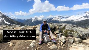
Don’t miss hiking Mt. Timpanogos in the Uinta-Wasatch-Cache National Forest, because this adventure is absolutely a bucket list item!

Chris & Mac
We outventure to help you outventure!
For us, outventuring isn’t just about adventure. It’s about the quiet moments — the first light on a ridgeline, the sound of a creek at camp, the shared laughter when the trail gets spicy. We believe the outdoors enriches people’s lives, and we want to help more folks experience that connection. Learn more about us HERE.
Scroll down for full slideshow.
Length: 11 Miles Round Trip to Emerald Lake (Approx.)
Trailhead(s): Aspen Grove Trailhead, Provo, UT
Elevation Gain: 3,421
Trail Type: Out & Back
Dogs: Allowed
Difficulty: Moderate to Strenuous
Permit Required? No
Considerations: Hazardous Snow Conditions May Be Present Into Early Summer
Season: Summer to Fall
Overview
Hiking Mt. Timpanogos from Aspen Grove is an excellent adventure filled with mind blowing views, waterfalls, and colorful scenery. Once the snow has melted off the trail by mid-summer, this hike is simply amazing. Not only are the wildflowers abundant and colorful, but the many waterfalls cascading down the rocks make hiking Mt. Timpanogos in the summer a true treat for the eyes. Further, the show is not over after the blooms fade! Instead, the foliage on Mt. Timpanogos transforms into an autumn wonderland. In fact, shimmering golds, oranges, and reds splendidly cover the mountain and surrounding hills with gorgeous, large swaths of the rich colors of fall.
HIKING MT. TIMPANOGOS
Because it is incredibly beautiful and fairly easy to access, Mt. Timpanogos is a popular place to day hike. It is not, however, a hike to be taken lightly. The mountain is beautiful, however it is a MOUNTAIN. Consequently, it is necessary to be prepared for hiking here.
Prepare, Prepare, Prepare – For Safety and Comfort
Mountains are fickle, and quite often also very rugged. Mt. Timpanogos is no exception. Hiking here can mean colder temperatures, gusty winds, and changing conditions at elevation. Further, the trails on Mt. Timpanogos traverse terrain that is rocky and rugged. As such, hikers are advised wear sturdy footwear for both comfort and safety for navigating the steep, rocky terrain of Mt. Timpanogos. Easily packed/carried clothing layers are also strongly recommended – even in the summer bring a jacket to shield against cold winds or light precipitation. Lastly, pack some snacks and water – staying fueled and hydrated makes the hike a lot more enjoyable and safe.
MT. TIMPANOGOS TRAILHEADS AND PARKING
Two different trailheads provide the easiest access to the summit. Although each has a good deal of parking, heavy usage during July and August means they fill quickly. To snag a parking spot during these peak months it is best to arrive early and/or avoid weekends and holidays.
Excellent views and an outstanding hike await – no matter which trailhead is chosen. While it is possible to thru hike from one trailhead to the other, the hike is nearly 15 miles. As such, to accomplish this in a day would require parking a car at each trailhead. Alternatively, spending a night or two on the mountain on a longer backpacking adventure is also an option.
Timpooneke Trailhead
The hike from the Timpooneke Trailhead to the summit of Mt. Timpanogos is a roughly 13 mile round trip hike with 4,400 feet of elevation gain. Because this trailhead is in the American Fork Canyon-Alpine Loop Recreation Area, a minimum $6 entrance fee is charged (or valid America the Beautiful Pass) to access the area. Additional information on this can be found here.
Aspen Grove Trailhead
The hike from the Aspen Grove Trailhead to the summit of Mt. Timpanogos is approximately a 17 mile round trip, with an elevation gain of 5,600 feet.
This is the trailhead we used to access Mt. Timpanogos for the two hikes we did here. We did not make it to the summit either time, but nonetheless absolutely enjoyed our time on the mountain.
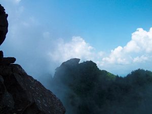
Our first attempt at hiking Mt. Timpanogos was in the summer. It was filled with waterfalls and wildflowers. We could hardly believe our eyes – it was remarkable. Conditions were warm and pleasant, and we planned for a trip to the summit. Unfortunately, we had to turn around well before even reaching Emerald Lake. During the hike we needed cell reception we did not anticipate before setting out (long, boring story), and the signal was not reliable on the mountain. Disappointed we had to terminate our hike, we vowed to return. The following October we were passing through the area and made a point of hiking Mt. Timpanogos again.
Just… WOW! The mountain was awash with fall color, and it was spectacular. It was also quite cold and windy up at Emerald Lake. We visited the shelter there and soaked in the views before deciding against going to the summit of Mt. Timpanogos. Winds were howling and it was cold. We were prepared for it, but darn… it was just unpleasant. Once again, we turned our hike before reaching the summit, but left ourselves with another reason to return.
Maybe next time we’ll try backpacking here. This mountains truly a bucket list adventure – no matter how far one wanders, or how long one stays. Mt. Timpanogos is truly “all that.”
Scroll down to learn about the GEAR WE USE and OTHER OUTVENTURES in this area.
Additional Information (Click below to follow links.)
Mt. Timpanogos Slideshow
(Click image to expand.)
Gear We Use for Day Hiking
To see descriptions of the gear Chris & Mac use for day hiking, as well as links to manufacturers and retailers offering the gear for sale, please CLICK HERE.
Articles About Other Regional Outventures that May Interest You (click to view):

SAFETY DISCLAIMER: The activities discussed in this website are outdoor activities and, as such, have inherent risks to which participants are exposed. It is not the intent of this website, nor is it possible due to the variability of weather, terrain, equipment, and experience, to detail all of those risks. The information contained in this site is informational, but not instructive nor exhaustive. It is the sole responsibility of the user to ensure he/she is in good health, fully prepared, and fully informed as to dangers before undertaking any of the activities discussed in this website and the user does so at his/her own risk. The user understands that by using this website he/she acknowledges and accepts all risks associated with use of information from this website and participation in any particular activity addressed herein. Please see “Terms of Use” for additional information.
Want to share this article with your friends? Click on the share button below:
Want more?
Get the latest outventure updates by following us on social media . . .