Take a hike on Shi Shi Beach and out to Cape Flattery to explore and admire the amazing, wild, and rugged coastline of the Olympic Peninsula.

Chris & Mac
We outventure to help you outventure!
For us, outventuring isn’t just about adventure. It’s about the quiet moments — the first light on a ridgeline, the sound of a creek at camp, the shared laughter when the trail gets spicy. We believe the outdoors enriches people’s lives, and we want to help more folks experience that connection. Learn more about us HERE.
Scroll down for full slideshow.
Length: 4-9 Miles Round Trip
Trailhead(s): Shi Shi Beach Trailhead
Elevation Gain: 550’
Trail Type: Out & Back
Dogs: Not Allowed
Difficulty: Easy to Moderate
Permit Required? Yes – $10 Annual Makah Recreation Pass
Considerations: Crowded in Summer
Season: Year Round
Overview
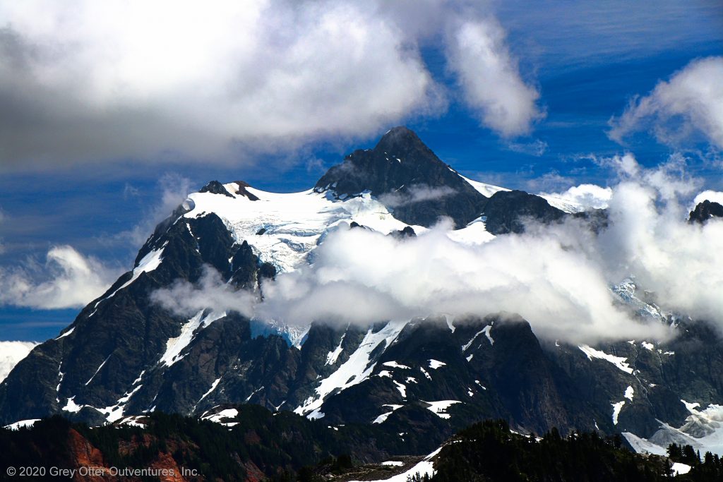
The sea stacks, sea caves, towering cliffs, and beaches of the Olympic Coastal Wilderness are ruggedly beautiful. One of the best ways to explore these amazing coastal features is to hike beautiful Shi Shi Beach. Additionally, while you are in the area, don’t miss Cape Flattery because it will blow you away!
MAKAH INDIAN RESERVATION
The Makah Tribal Reservation covers the entirety of the northwestern tip of the Olympic Peninsula. As such, the Makah Tribe controls all access to an incredible stretch of the Olympic Wilderness Coast This means the Makah Tribe sets the rules for access to both Cape Flattery and Shi Shi Beach.
Although Cape Flattery is on the Makah Reservation, Shi Shi Beach is in Olympic National Park. This can be confusing when it comes to which passes or permits are needed. Make no mistake. The Makah Tribe is in charge. Cape Flattery and access to it is fully within their tribal lands. However, Shi Shi Beach is in the national park, but the trailhead for it is on the Makah Reservation.
Makah Recreation Pass
Consequently, visiting either Cape Flattery or Shi Shi Beach requires only a Makah Recreation Pass. A national park pass is NOT needed when visiting either of these locations.
The Makah Recreation Pass is good for one year and can be purchased in Neah Bay at these locations: Makah Marina, The Museum at the Makah Culture and Research Center, Washburn’s General Store, Makah Mini Mart, or the Makah Tribal Center. It can also be purchased at Hobuck Beach Resort located north of Shi Shi Beach. Display this pass on the dash of your vehicle while exploring the trails, beaches, and any other attractions on the Makah Reservation.
SHI SHI BEACH
Remote, scenic, and ruggedly beautiful, Shi Shi Beach is a delightful place to take a hike. It has a sandy beach, soaring cliffs, and an incredible array of sea stacks. Although it is in Olympic National Park, the easiest and most direct access to it is from the Makah Reservation.
Shi Shi Beach Trailhead
The trailhead for Shi Shi Beach is near the fish hatchery on the Makah Reservation. As previously mentioned, a Mikah Recreation Pass is required to park here. You may note other parking areas nearby – ignore them. They are for people camping on Shi Shi Beach because overnight parking is not permitted at the trailhead.
Hiking to Shi Shi Beach
The trail to Shi Shi Beach sets off immediately into the forest from the trailhead. Enjoy the boardwalks you travel for the first mile of this hike. Why? Because they keep feet out of mud, and the following mile is typically a mud-fest. It was for us, and we followed several well-trodden foot paths that bypassed the worst of them. Whether on boardwalk or not, however, the trail stays under the cover of the forest. We noted only one place with views and it was shortly before arriving at the beach.
Once the trail makes a hard right towards the ocean the steep path descends quickly down to Shi Shi Beach. Hikers are aided here by a permanent rope installation.
Hiking on Shi Shi Beach
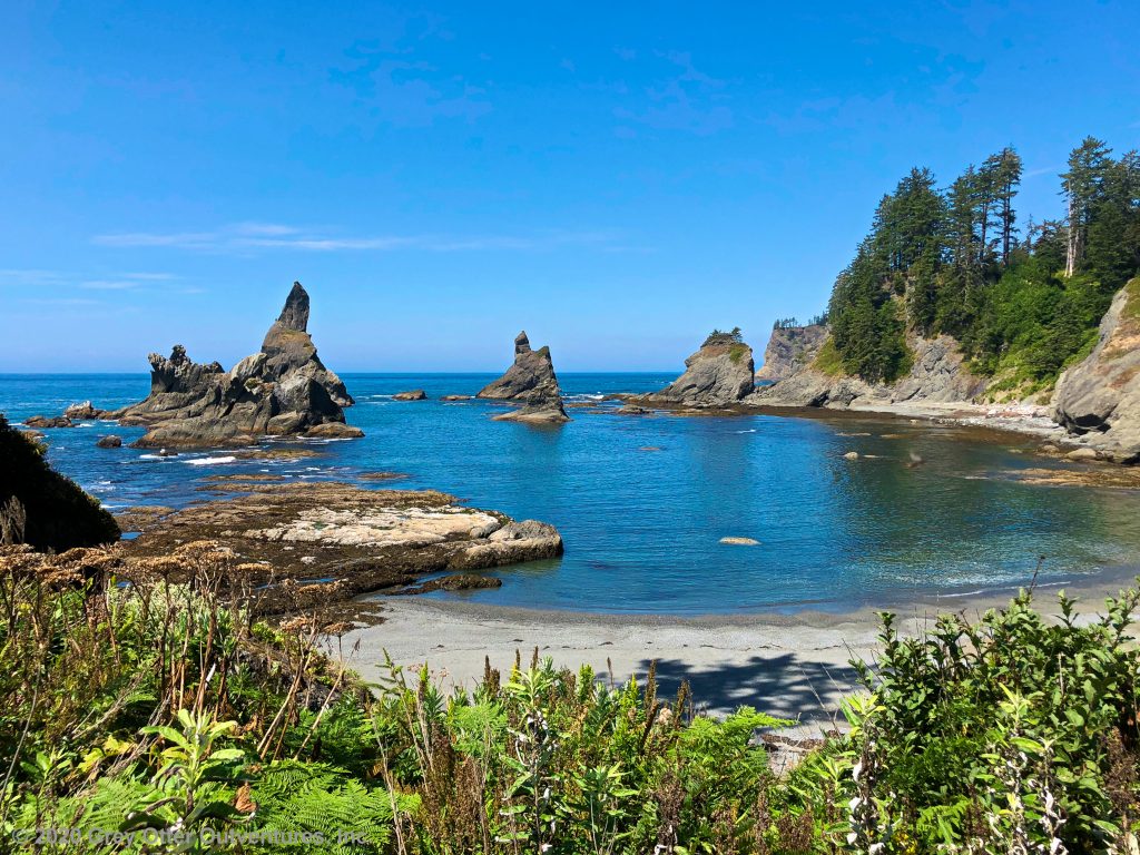
There are no trails on Shi Shi Beach. This lovely, sandy cove has towering cliffs that drop right down to the sea on its northern end. Looking south, however, this beautiful cove stretches out for about a mile before the cliffs once again meet the Pacific Ocean. In the distance, a shadowy line of sea stacks marks the end of the cove.
The terrain thus dictates the direction of travel, and hikers head south to explore this beach. The far end of the cove is known as the Point of Arches. This line of sea stacks juts far out into the ocean. At low tide the tidepools around them are fun to explore for kids of all ages.
Be keenly aware of the tides if hiking past this point. Rising tides can and have trapped people in areas that have no way out. Look for the headland routes if you hike past the point. They are marked by a circular sign with black and orange triangles. Rope installations assist hikers in navigating up and down the steep slopes of the rugged cliffs. If the tides are low enough, some of the headland routes are optional. Others are not – they are the only way to get around non-passable areas of the shoreline.
Because of the possible hazards and headland routes, most day hikers do turn around at this point. After all, this hike is truly all about lingering, poking around, and exploring an exceptional stretch of the coast. Shi Shi Beach is thus a magical place. However, it is not alone.
If time allows, either before or after hiking Shi Shi Beach, make the short trip out to fabulous Cape Flattery. It is the magnificent northernmost tip of the continental United States.
CAPE FLATTERY
The hike out to Cape Flattery is short and not too difficult. It is roughly a mile and a half round trip, and the elevation gain is less than 300 feet. Thus the sea stacks, coves, and caves on this point are delightful, and they are easy to get to. As such, anyone who hikes Shi Shi Beach should allow sufficient time to also visit Cape Flattery. It is less than 10 miles between the trailheads, and it takes less than 25 minutes to drive from one to the other.
Even though they are not far apart, the experience we have at these two locations is entirely different. This is mostly because there is no access to the water at Cape Flattery. Unlike Shi Shi Beach, all of the cliffs at Cape Flattery drop right down to the sea. There is no beach access. Consequently, this hike is all about the viewpoints once you get out to the cliffs.
Hiking Cape Flattery
This out and back hike begins by following a wide gravel path down to a boardwalk. Although parts of this trail are natural, the trail out to Cape Flattery is primarily a series of boardwalks. Just like at Shi Shi Beach, the boardwalks help keep hikers out of the mud. They also help protect sensitive areas from foot traffic and erosion.
Upon reaching the cape, the boardwalk has three offshoots to explore. Two of them allow visitors to peer into the coves to the south and the north of the point. The first offers a view to the south overlooking a dramatic cove with gorgeously decorated sea stacks. The second offshoot has views to the north and is two tiered. The top tier has sweeping views of the coves on this side of the point, whereas the lower tier offers intimate views of the sea caves here.
The last offshoot takes visitors to a viewing platform at the tip of the cape. It involves descending a short ladder. From this platform visitors are treated to sweeping views in all directions. Cape Flattery Reef is visible to the north, and Kessiso Rocks are observable to the south. Tatoosh Island, with its lonely sentinel lighthouse, is straight ahead. Observe not only the incredible terrain from this viewpoint, but look closely for wildlife as well. In addition to the sea birds, you might just spot a whale, sea otter, or sea lion here!
When you are done exploring all three of the offshoots here, turn around and head back the way you came. I hope the images, sounds, and smells of these incredible places linger long in your memory and bring you much joy. Outventure on!
Scroll down to learn about the GEAR WE USE and OTHER OUTVENTURES in this area.
Additional Information (Click below to follow links.)
Shi Shi Beach & Cape Flattery Slideshow
(Click image to expand.)
Gear We Use for Day Hiking
To see descriptions of the gear Chris & Mac use for day hiking, as well as links to manufacturers and retailers offering the gear for sale, please CLICK HERE.
Articles About Other Regional Outventures
SAFETY DISCLAIMER: The activities discussed in this website are outdoor activities and, as such, have inherent risks to which participants are exposed. It is not the intent of this website, nor is it possible due to the variability of weather, terrain, equipment, and experience, to detail all of those risks. The information contained in this site is informational, but not instructive nor exhaustive. It is the sole responsibility of the user to ensure he/she is in good health, fully prepared, and fully informed as to dangers before undertaking any of the activities discussed in this website and the user does so at his/her own risk. The user understands that by using this website he/she acknowledges and accepts all risks associated with use of information from this website and participation in any particular activity addressed herein. Please see “Terms of Use” for additional information.
Want to share this article with your friends? Click on the share button below:
Want more?
Get the latest outventure updates by following us on social media . . .