Hike the Siyeh Pass Trail in Glacier National Park, and be dazzled by its breathtakingly beautiful mountains, valleys, lakes, glaciers, and waterfalls.

Chris & Mac
We outventure to help you outventure!
For us, outventuring isn’t just about adventure. It’s about the quiet moments — the first light on a ridgeline, the sound of a creek at camp, the shared laughter when the trail gets spicy. We believe the outdoors enriches people’s lives, and we want to help more folks experience that connection. Learn more about us HERE.
Scroll down for full slideshow.
Length: 10.6 Miles
Trailhead(s): Siyeh Bend (Start) / Sunrift Gorge Pullout (Finish)
Elevation Gain: 2,240’ (3,440′ Loss)
Trail Type: Point to Point
Dogs: Not Allowed
Difficulty: Moderate to Strenuous
Permit Required? A Going-to-the-Sun Road Vehicle Reservation is required for each vehicle accessing the Going-to-the-Sun Road from May 27 through September 11, 2022, from 6 am to 4 pm. This is for all points between the West Glacier, Camas, and St. Mary entrances. The reservation is valid for 3 days and the cost is $2. Online reservations begin March 2,2022. Follow this link to obtain reservation: Recreation.Gov
Visitors with lodging, camping, transportation, or commercial reservations within these areas may use their service reservation receipt and do not need a vehicle reservation. Valid only for date(s) of service reservation.
ST MARY ENTRANCE: A vehicle reservation is not required at the St. Mary Entrance prior to the Going-to-the-Sun Road being fully open, typically around June. Once snow removal and road preparations are complete, vehicle reservations are required at the Rising Sun area.
Considerations: National Park Entry Fee $35
Season: Late June/Early July – October
Overview
Possibly one of the best hikes in Glacier National Park, the Siyeh Pass Trail takes you into the heart of the park to see waterfalls, meadows, glaciers, mountains, valleys, and lakes.
SIYEH PASS HIKE
Hiking Up to the Siyeh Pass Trail
From Siyeh Bend, look across the road for the stub trail which follows Siyeh Creek. A short ways in it disappears into the forest and begins ascending. After about a mile this stub trail connects with the Piegan Pass Trail which leads to the Siyeh Pass Trail. The Piegan Pass Trail takes hikers through the peaceful forest, but there are not really any views. There are, however, gorgeous trees, lovely wildflowers and some fairly steep, short climbs before reaching the Siyeh Pass Trail.
The Siyeh Pass Trail
The Siyeh Pass Trail is nothing like the trail getting to it. Views start opening up as the trail makes its way through Preston Park where hikers are treated to gorgeous meadows and wildflowers. This is a charmingly pretty valley. Stands of pine trees along the trail provide welcome shade, but we found the mosquitoes thick there so we could not linger to cool off. Even in the full sun we had to keep moving or they would swarm. Thankfully this was the only place we encountered them. Once the terrain turned rocky we noticed that the mosquito problem disappeared as quickly as it had appeared. Standing before the mound of rock before us after crossing Siyeh Creek, our attention was fully on the climb. Yours will be too.
The final climb of 900 feet up to Siyeh Pass comes shortly after crossing Siyeh Creek. I will not sugar coat this one. It’s a steep, rocky, and rigorous climb. Further, the small saddle you see above you as you climb to the pass (and are secretly hoping with each step that it marks the end of the climb) is not the end of the climb. The trail actually climbs another 200 feet up a few more steep switchbacks before it finally reaches its highest point at 8,100 feet. After that, it’s pretty much all downhill.
Siyeh Pass
Much easier to navigate now, the trail traverses a small ledge on the pass with spectacular views of the Boulder Creek and Baring Creek valleys. While exceptional views of Glacier National Park are literally everywhere in the park, they are truly gorgeous here and include the Going-to-the-Sun Mountain, Sexton Glacier, and Goat Mountain. Farther in the distance Red Eagle Mountain, Mahtotopa Mountain, and Little Chief Mountain are visible, as is a small sliver of St. Mary Lake. The trail soon begins descending, so if time allows, take a well deserved break on the rocks before beginning the long descent.
Hiking Down From the Pass
Descending now, the Siyeh Pass Trail works its way down from its peak elevation via a series of multiple switchbacks. Some of them are quite long, and at times it feels like they will never end. Since the trail drops nearly 1,450 feet over 2.5 miles there is good reason to feel this way. Even so, the views and the gorgeous multi-hued rocks along this stretch of the trail are mind-blowing. We spotted a few marmot as well. Following these never ending descending switchbacks, the next mile and a half flattens out to give weary knees a welcome break.
The trail must keep going down, however, and the switchbacks begin again. The first one at the end of the flat stretch has a nice view of St. Mary Lake and Little Chief Mountain. Surprising, but then again not because change is the norm on this hike, the terrain changes once more as the trail switchbacks down through a forest of stunted trees (krummholz) towards Baring Creek. It’s a bizarre scene that we found eerily interesting. At the end of these switchbacks, the trail leads to a waterfall and gushing stream cutting through a striking red rock gorge.
The Final Leg of the Hike
This part of the trail, accompanied by the stream, gorgeous red rocks, and plentiful wildflowers, was especially pleasant. Following the natural contours of the land down to its end at the Going-to-the-Sun Road, the trail takes its final turn into trees as it follows the stream, although not at its edge any longer. The shade for the final stretch out was greatly appreciated, since we had been in the sun now for quite awhile. We thus emerged from Sunrift Gorge onto the Going-to-the-Sun Road hot and tired, but hugely fulfilled after traveling through such varied and beautiful terrain. Would we hike this again? Absolutely. The Glacier National Park Siyeh Pass Trail hike is a bucket list hike worthy of a repeat.
Travel & Parking in Glacier National Park
Competition for parking anywhere in the park is fierce, especially during the park’s busiest months of July and August. We visited and hiked as much of this park as we could during our full month stay here during the month of July. Traffic got heavier and heavier as more visitors came. By the end of the month parking anywhere in the park was an absolute nightmare. We saw a steady stream of vehicles being waved away and blocked from entering the full lot at the Logan Pass Visitor Center. Everywhere else, we watched cars endlessly circling lots that were already full by 9 or 10am. Though Siyeh Bend has parking, it is very limited so depending on snag a spot there is definitely taking a big gamble.
What to do instead? Ride the buses. The park has free shuttle buses which serve all the trailheads and major points of interest along the Going-to-the-Sun Road. The lines for the shuttles can be long and frustrating, so on this point I will be brutally honest. It’s no fun hanging out in these lines, and sometimes the wait is long. I know because we waited in them many times. It was far less frustrating to wait in them, however, than it was to try to find a parking spot in Glacier National Park after 10am. Our best advice is to plan your day, check the shuttle schedules, get up early, snag a parking spot, and then let the shuttles transport you to and from your adventure.
Scroll down to learn about the GEAR WE USE and OTHER OUTVENTURES in this area.
Additional Information (Click below to follow links.):
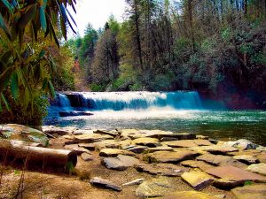
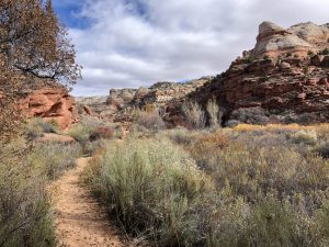
Siyeh Pass Trail Slideshow
(Click image to expand.)
Gear We Use for Day Hiking
To see descriptions of the gear Chris & Mac use for day hiking, as well as links to manufacturers and retailers offering the gear for sale, please CLICK HERE.
Articles About Other Regional Outventures that May Interest You (click to view):


SAFETY DISCLAIMER: The activities discussed in this website are outdoor activities and, as such, have inherent risks to which participants are exposed. It is not the intent of this website, nor is it possible due to the variability of weather, terrain, equipment, and experience, to detail all of those risks. The information contained in this site is informational, but not instructive nor exhaustive. It is the sole responsibility of the user to ensure he/she is in good health, fully prepared, and fully informed as to dangers before undertaking any of the activities discussed in this website and the user does so at his/her own risk. The user understands that by using this website he/she acknowledges and accepts all risks associated with use of information from this website and participation in any particular activity addressed herein. Please see “Terms of Use” for additional information.
Want to share this article with your friends? Click on the share button below:
Want more?
Get the latest outventure updates by following us on social media . . .